QUESTIONS? GIVE US A CALL! 1 (877) 921-6277 or (403) 266-2241
WE SHIP EVERYWHERE!
QUESTIONS? GIVE US A CALL! 1 (877) 921-6277 or (403) 266-2241
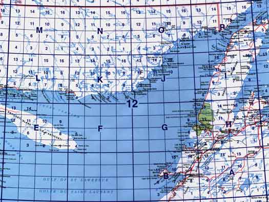
Click on an area of the map below to zoom in on each topo map index.
Back to the Newfoundland and Labrador Topographical Maps Index.
Each lettered square on the topo map index above represents the following 1:250 000 scale topographic maps: 12A - Red Indian Lake, 12B - Stephenville, 12E - Ile D'Anticosti, 12F - Baie Du Renard, 12H - Sandy Lake, 12I - Port Saunders, 12J - Harrington Harbour, 12K - Musquaro, 12L - Havre-Saint-Pierre, 12M - Lac De Morhiban, 12N - Rivière Natashquan, 12O - Saint-Augustin, 12P - Blanc-Sablon.
Click on the topo map index above to see more detailed maps and information about Newfoundland and Labrador topographical maps.


