QUESTIONS? GIVE US A CALL! 1 (877) 921-6277 or (403) 266-2241
WE SHIP EVERYWHERE!
QUESTIONS? GIVE US A CALL! 1 (877) 921-6277 or (403) 266-2241
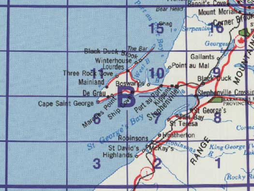
Use the following image to move to adjacent topo map indexes.

Back to the Newfoundland and Labrador Topographic Maps Index.
12B - Stephenville, 12B01 - Dashwoods Pond, 12B02 - St Fintan'S, 12B03 - Little Friars Cove, 12B06 - Cape St George, 12B07 - Flat Bay, 12B08 - Main Gut, 12B09 - Harrys River, 12B10 - Stephenville, 12B11 - Mainland, 12B15 - Shag Island, 12B16 - Georges Lake


