QUESTIONS? GIVE US A CALL! 1 (877) 921-6277 or (403) 266-2241
WE SHIP EVERYWHERE!
QUESTIONS? GIVE US A CALL! 1 (877) 921-6277 or (403) 266-2241
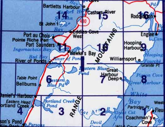
Use the following image to move to adjacent topo map indexes.

Back to the Newfoundland and Labrador Topographic Maps Index.
12I - Port Saunders, 12I01 - Fleur De Lys, 12I02 - Cat Arm River, 12I03 - Indian Lookout, 12I04 - Portland Creek, 12I05 - Part Of 12I06 Bellburns, 12I06 - Bellburns, 12I07 - Soufflets River, 12I08 - Great Harbour Deep, 12I09 - Englee, 12I10 - Torrent River, 12I11 - Port Saunders, 12I14 - St John Island, 12I15 - Castors River, 12I16 - Roddickton


