QUESTIONS? GIVE US A CALL! 1 (877) 921-6277 or (403) 266-2241
WE SHIP EVERYWHERE!
QUESTIONS? GIVE US A CALL! 1 (877) 921-6277 or (403) 266-2241
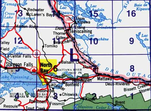
Use the following image to move to adjacent topo map indexes.

Back to the Block 031 Topographic Map Index.
31L - North Bay, 31L01 - Brent, 31L02 - Kiosk, 31L03 - Powassan, 31L04 - Nipissing, 31L05 - Sturgeon Falls, 31L06 - North Bay, 31L07 - Mattawa, 31L08 - Rivière Maganasipi, 31L09 - Lac Bleu, 31L10 - Lac Beauchêne, 31L11 - Témiscaming, 31L12 - Marten Lake, 31L13 - Ingall Lake, 31L14 - Ottertail Creek, 31L15 - Lac Grindstone, 31L16 - Lac Sairs. One or more of these maps cover the northern portion of Algonquin Provincial Park, Mattawa River Provincial Park, South Bay Provincial Park and Restoule Park


