QUESTIONS? GIVE US A CALL! 1 (877) 921-6277 or (403) 266-2241
WE SHIP EVERYWHERE!
QUESTIONS? GIVE US A CALL! 1 (877) 921-6277 or (403) 266-2241
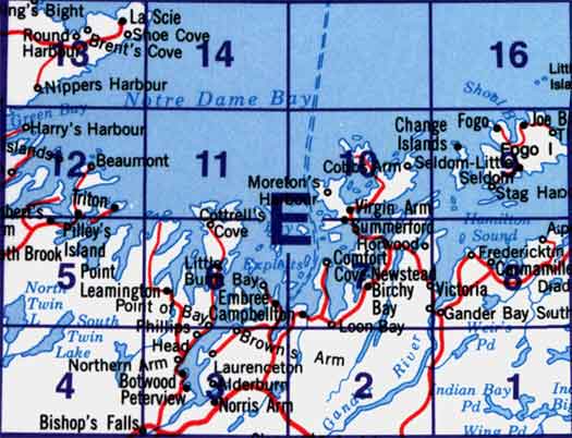
Use the following image to move to adjacent topo map indexes.


Back to the eastern Newfoundland Topographical Maps Index.
2E - Botwood, 2E01 - Weir's Pond, 2E02 - Gander River, 2E03 - Botwood, 2E04 - Hodges Hill, 2E05 - Robert'S Arm, 2E06 - Point Leamington, 2E07 - Comfort Cove-Newstead, 2E08 - Carmanville, 2E09 - Fogo, 2E10 - Twillingate, 2E11 - Exploits, 2E12 - Little Bay Island, 2E13 - Nippers Harbour, 2E14 - Cape St. John, 2E16 - Little Fogo Islands.


