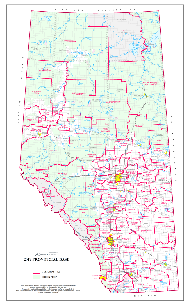
The County or Municipal District
The County or Municipal District
The County or Municipal District
The County or Municipal District
The County or Municipal District
The County or Municipal District
The County or Municipal District
Alberta Sustainable Resource Development
The County or Municipal District
The County or Municipal District
The County or Municipal District
The County or Municipal District
The County or Municipal District
The County or Municipal District
The County or Municipal District
The County or Municipal District
The County or Municipal District
The County or Municipal District
The County or Municipal District
The County or Municipal District
The County or Municipal District
The County or Municipal District
The County or Municipal District
The County or Municipal District
The County or Municipal District
The County or Municipal District
The County or Municipal District
Alberta Sustainable Resource Development
The County or Municipal District
The County or Municipal District
The County or Municipal District
The County or Municipal District
The County or Municipal District
The County or Municipal District
Alberta Sustainable Resource Development
Alberta Sustainable Resource Development
The County or Municipal District
The County or Municipal District
The County or Municipal District
The County or Municipal District
The County or Municipal District
The County or Municipal District
The County or Municipal District
The County or Municipal District
The County or Municipal District
The County or Municipal District
The County or Municipal District
The County or Municipal District
The County or Municipal District
The County or Municipal District
The County or Municipal District
The County or Municipal District
The County or Municipal District
The County or Municipal District
The County or Municipal District
The County or Municipal District
The County or Municipal District
The County or Municipal District
The County or Municipal District
The County or Municipal District
The County or Municipal District
The County or Municipal District
The County or Municipal District
